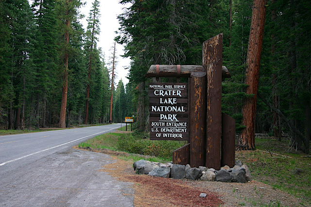
We pulled up to the small booth housing the short-straw-wielding park ranger stuck with gate duty that day. “Where’s the best place for a hike this time of year,” I asked. His blunt response made our hearts sink, “Outside of the park.” Several miles back we had begun to see snow on the side of the road. As we climbed the shallow slope towards the caldera, the snow rose like an ancient gateway leading us to the throne room. By the time we had reached the south gate of Crater Lake National Park, the melting snow pack was five feet deep. This guaranteed that all of the parks trails were snowed over and our objective, the lake’s Crater Rim Trail, bordered by high cliffs of the caldera’s rim and a steep drop to the frigid lake below, was too treacherous for ordinary tourist travel.

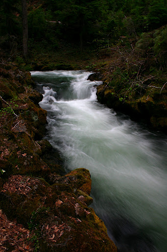
A view of Munson Creek with the famous caldera looming above
Since there was no longer a rush we stopped to grab a bite to eat at the gift shop diner, but not before challenging our newfound nemesis to a duel. Melissa and her father, Andy, did their best to beat the snow into submissions but at the end of the day they were vastly outnumbered. Tired from battle, we retreated into the forest citadel for grub. Our Eastern European waiter seemed somewhat new and we added to his confusion, as we usually do, with complicated orders rendering our desired meal as vegan as we can make it. In most cases we’re able to construct a decent meal from the most unfriendly of menus, and this time we were lucky to find ready-made vegan options like the ever-satiating veggie burger. As Melissa and her parents devoured what was left of our meal, I stepped outside to survey the winter landscape. Keep in mind that it’s early June--summer comes late to the Cascades. After the initial snow blindness subsided, I looked up to see a hazy ring around the sun. This usually means a storm front will arrive within 12 hours. Sure enough, five hours later it was raining.
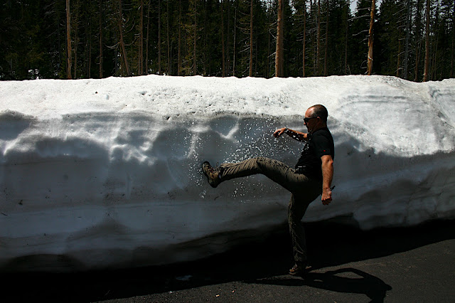
Andy showing the snow who's boss
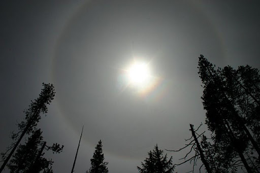
Sun halo signaling incoming precip
________
Crater Lake, the deepest lake in the United States and seventh place among all of earth’s lakes, was formed with the collapse of an ancient volcano named Mount Mazama around 5,000 BCE. Mazama was one in a chain of volcanoes stretching from northern California to Washington along the Pacific Ring of Fire. Although modern science wasn’t around to witness the eruption and subsequent implosion, geologists have discovered remnants of fallout ash hundreds of miles away in eastern Montana and Saskatchewan, Canada. For an idea of scale, Mount Saint Helens, one of the largest eruptions in the United State’s modern history, was over forty times weaker than the eruption of Mount Mazama.
For years pressure had been building under Mazama. According to Klamath tribal legend, a chiefly battle was being waged between Llao of the below world and Skell of the above. As pyroclastic flows and small eruptions released magma and hot gases, some as far as 25 miles from Mazama’s peak, a giant underground cavern was created. Mazama’s weight proved too great and the mountain collapsed in a giant, fiery implosion 50,000 greater than the nuclear bomb dropped on Nagasaki. The destruction of Llao’s home signaled the great chief’s defeat.
________
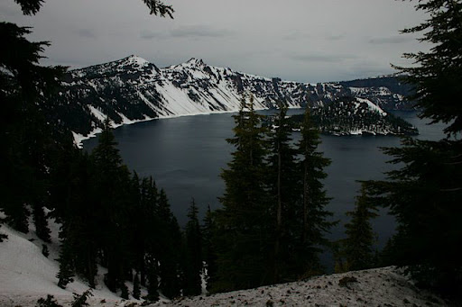
Crater Lake and Wizard Island (likened to a wizard's hat)
After taking in views of Crater Lake, we retreated below the snow line for some hiking. After all, it’s what we came to do. We drove south, out of the park, then west down the mountain. After several miles we saw a sign signaling hiking. Since it was getting late in the day and we had no particular goal in mind we took the turnout and headed down a dirt road. After a few miles we reached the trailhead.
Upper Union Creek Falls
We soon discovered our hiking destination--Upper Union Creek. The trail dropped down into a shallow valley to the foot of Upper Union Creek Falls, a series of moss-lined mini cataracts surrounded by old growth forest. As Melissa and her parents hiked ahead I dallied about like a gnome arrested by each forest resident--a funnel web, a babbling brook, lichen-ridden bark, forest ferns, each unique in intricacy and beauty. I took it in and fell behind. After a half hour passed, I decided to catch up.
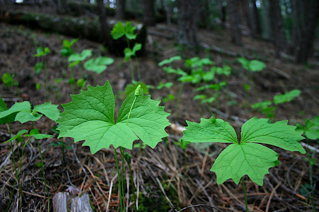
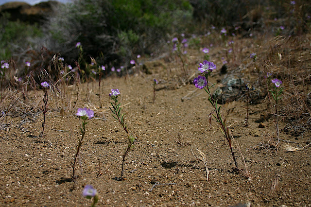
These strange plants adorned the hillside
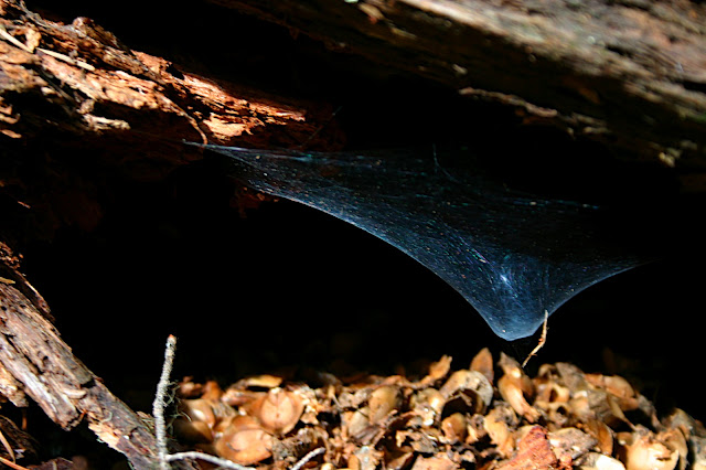
Funnel web hiding under a log
I found the group stopped by a small, natural dam. The creek was swollen with snow melt and pouring over the trees, which had fallen into the creek. After some Indiana Jones-like stunts to cross the river and photograph the scene, we trudged down the path. Andy eventually fell back and the remaining three pursued an open-ended goal. Each bend brought a new breathtaking scene as we followed the creek down, down, down. We took intermitted stops to photograph scenes, practice ninja skills, and enjoy life. After an hour and a half, with night quickly approaching, we decided to rush back. Melissa’s mother led as we jogged back to the vehicle in half the time. As I reached the car, brining up the rear, I looked up just in time catch a rain drop on my cheek.
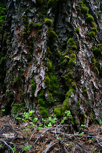
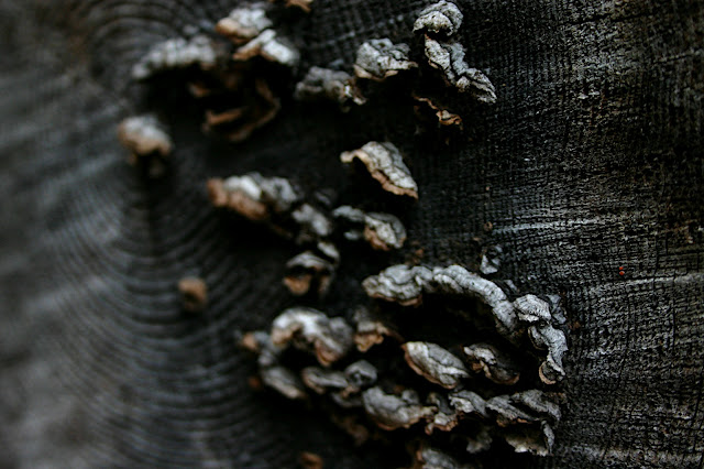
Moss and lichen
Fairy stools upon a felled tree
________
Lava Beds National Monument
From our base in Klamath, OR we were a short jaunt away from Lava Beds National Monument. Having never heard of this geologic wonder, I was excited to explore. We crossed into California and soon reached the eastern edge of the monument.
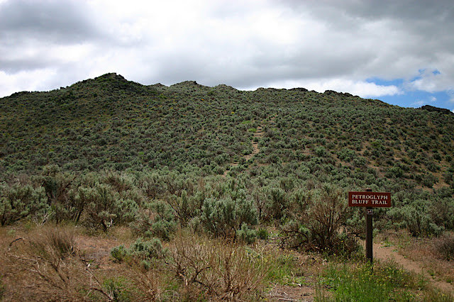
The misleading "Petroglyph Bluff Trail"
Our first hike was up Petroglyph Bluff. Unlike its appellation suggests this was not a bluff, nor did we find any petroglyphs up top (they were all at the base). We’re convinced this was a ploy to cajole lazy tourists into hiking. Either way, we were rewarded with stunning views of the Tule Lake National Wildlife Refuge and Lava Beds. The plaque atop the “bluff” informed that we had just climbed the back of the great Creator. According to Modoc lore, after the world was created the giant lay here to slumber for eternity. It's sacred ground to the local tribes. From our perch high above the valley floor, as the wind whispered through the rocks, there was a sense of hollowed ground.
Hallowed ground: on top of Petroglyph Bluff
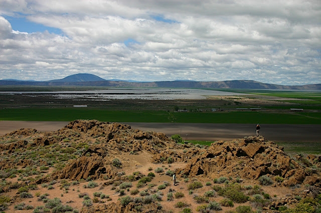
View of Tule Lake from Petroglyph Bluff
Upon descending and discovering the true location of the petroglyphs, we headed into the monument. From the East, we first passed Captain Jack’s Stronghold. From here Kintpuash, or “Captain Jack” as he came to be known, led a small band of Modoc warriors against the United States Army, sent to force the Native Americans back onto a reservation to the North. For five months the Army laid siege to the natural fortress and for five months the small band of Modoc repelled the attacks. The Modoc campaign was doomed for failure, as the odds stacked ever higher against them. Captain Jack was eventually forced to surrender after a band of Modocs agreed to hunt him down. He was hanged shortly thereafter, but immortalized through his bold campaign.
_________
As we drove further into the park we saw vast fields of A’a (pronounced Ah-Ah) lava, part of the Devil’s Homestead Flow. Further down the road, we visited the petrified Fleener Chimneys where we discovered remnants of Pahoehoe (pronounced Pa-hoy-hoy) lava. A’a is formed as the surface of a lava flow cools and forms rough, jagged blocks. Pahoehoe is formed at higher temperatures, resulting in smooth, ropy rock.
From the visitor’s center we embarked on a journey to explore the monument’s dark, sinuous lava tubes. Ever since a botched spelunking trip at Mammoth Cave National Park in Kentucky, I had wanted to descend into the bowels of the earth armed with nothing more than a few lights and my wits. As we crawled into the earth a cool wave brought a reprieve from the early summer sun.
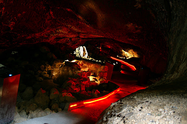
Mushpot Cave, the neon-laden "beginner" lava tube
When this region was active, the walls of underground lava flows cooled forming protective tubes. The magma rivers eventually subsided, leaving behind a network of natural subways. For hours we ducked in and out of caves, each unique in character. There was the neon-lit Mushpot Cave, an officially proclaimed “beginner’s cave”. Then, the deep, dark Golden Dome cave with multiple branches, low ceilings, and ropy, igneous floor. Last but not least, Sunshine Cave with several collapsed ceilings lending a soft, diffused light to its smooth walls. The last was my favorite, although they were all spectacular.
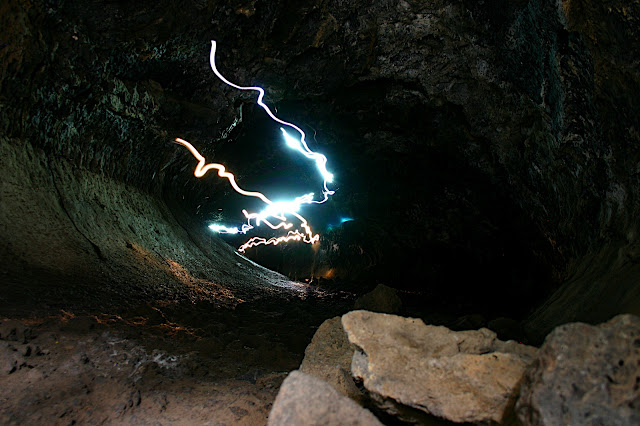
Spelunkers donning headlamps exit Golden Dome lava tube
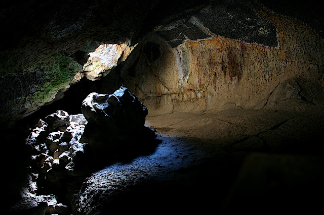
Collapsed roof in Sunshine Cave
Like scuba diving, spelunking leads you into a separate realm--a cool, subterranean world where one can explore the earth’s natural wonders in an alien environment. As we crawled out to rejoin the sunlit world, one could not help but feel a fond sense of satisfaction for the day’s deeds. We had climbed the back of a slumbering Creator, learned of a bold warrior’s last stand, received a hands-on volcanologic lesson, and explored some of earth’s most unique geologic wonders. We drove north to Oregon tired and hungry from a long day. I looked out the window to see a few swans floating on Tule Lake. Dozing off, I dreamed of an earlier time, a different culture, and I thought to myself, “Had I been born here in the mid-1800s, the natural fortress might have been named ‘Captain Jon’s stronghold’.”


1 comment:
you words and pictures flow together very nicely to stitch a compelling portrait of adventure, knight owl.
fyi, the olympic peninsula is eagerly awaiting a champion fabulist to confess its secrets to! (the olympics and cascades have a bit of a rivalry.)
Post a Comment